


SW 4, Cuming County, Nebraska
About
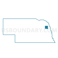
Outline

Summary
| Unique Area Identifier | 612624 |
| Name | SW 4 |
| County | Cuming County |
| State | Nebraska |
| Area (square miles) | 144.02 |
| Land Area (square miles) | 143.76 |
| Water Area (square miles) | 0.25 |
| % of Land Area | 99.82 |
| % of Water Area | 0.18 |
| Latitude of the Internal Point | 41.83761020 |
| Longtitude of the Internal Point | -96.91174110 |
Maps


Graphs
Select a template below for downloading or customizing gragh for SW 4, Cuming County, Nebraska


Neighbors
Neighoring Voting District (by Name) Neighboring Voting District on the Map
- 6 Precinct, Colfax County, NE
- Beemer & Logan Precinct, Cuming County, NE
- Haymow Precinct, Stanton County, NE
- Kingsburg Precinct, Stanton County, NE
- Maple Creek Precinct, Stanton County, NE
- Pebble Precinct, Dodge County, NE
- St. Charles Sherman Garfield & Cuming Precinct, Cuming County, NE
- Webster Precinct, Dodge County, NE
- Wisner, Blaine & Grant Precinct, Cuming County, NE
Top 10 Neighboring County Subdivision (by Population) Neighboring County Subdivision on the Map
- Webster township, Dodge County, NE (886)
- Beemer township, Cuming County, NE (862)
- Lincoln precinct, Colfax County, NE (753)
- Sherman township, Cuming County, NE (544)
- Pebble township, Dodge County, NE (489)
- Elkhorn township, Cuming County, NE (253)
- Monterey township, Cuming County, NE (205)
- St. Charles township, Cuming County, NE (204)
- Logan township, Cuming County, NE (201)
- Lincoln township, Cuming County, NE (199)
Top 10 Neighboring Unified School District (by Population) Neighboring Unified School District on the Map
- West Point Public Schools, NE (5,951)
- Wisner-Pilger Public Schools, NE (2,559)
- Scribner-Snyder Community Schools, NE (1,821)
- Dodge Public Schools, NE (1,109)
- Howells Public Schools, NE (1,078)
Top 10 Neighboring State Legislative District Upper Chamber (by Population) Neighboring State Legislative District Upper Chamber on the Map
- State Senate District 15, NE (36,691)
- State Senate District 22, NE (35,193)
- State Senate District 16, NE (31,475)
Top 10 Neighboring 111th Congressional District (by Population) Neighboring 111th Congressional District on the Map
Top 10 Neighboring Census Tract (by Population) Neighboring Census Tract on the Map
- Census Tract 9636, Dodge County, NE (5,026)
- Census Tract 9727, Cuming County, NE (2,616)
- Census Tract 9729, Cuming County, NE (2,272)
- Census Tract 9646, Colfax County, NE (2,225)
- Census Tract 9621, Stanton County, NE (1,593)
Top 10 Neighboring 5-Digit ZIP Code Tabulation Area (by Population) Neighboring 5-Digit ZIP Code Tabulation Area on the Map
- 68788, NE (4,898)
- 68791, NE (1,800)
- 68057, NE (1,544)
- 68633, NE (1,179)
- 68641, NE (1,063)
- 68716, NE (1,011)
- 68768, NE (642)